At this time of the year, there are often changes made to land parcels – areas are sold off, given up, taken on, and boundaries changed and so it is worth reflecting on those and keeping the RPA maps up to date. This in your interest, especially as we now only have multi-annual schemes in place.
Mapping has, over the years, been an emotive subject, and some still face challenges ‘in getting their maps correct or back to what was correct’.
The NFU continues to work with the RPA as it develops its mapping process and schemes to ensure members’ concerns are considered.
Accurate mapping is as important now as it was in the past. While we have seen the ending of BPS and the associated annual application process, all continuing land-based and some capital grant schemes rely on the RPA’s mapping database.
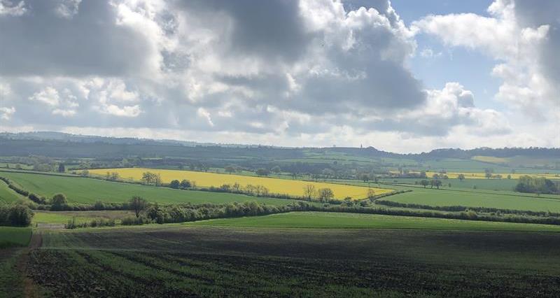
The RPA manages an online land database that covers around 2.7m land parcels (covering around 75% of England and includes arable / grassland, woodland, ponds and farmyards) and associated land covers such as arable and permanent grassland which you can view on the RPA rural payments service.
How mapping is updated
Mapping is updated via three main routes.
- RPA checks mapping against the claimant’s agreements and land claims (a farm visit by an RPA field officer, or remote inspections using satellite or aerial imagery).
- Proactive land change detection where the RPA reviews a proportion of land parcels every year to ensure the accuracy of its database with the likes of Ordnance Survey datasets.
- Claimants / agreement holders telling the RPA of changes to their RPA mapping records.
This activity ensures the basis of scheme payments are accurate. More regular updates and use of spatial analysis helps the RPA see which potential land parcels will receive updated intelligence during the year.
The RPA looks to ensure farmers stay compliant, before any breaches are likely to occur.
Post BPS – mapping and keeping digital maps up to date
With 2023 being the last year that many farmers needed to consider their RPA mapping on an annual basis (when they completed their annual BPS claim), the RPA is keen to ensure that its mapping details are kept up to date.
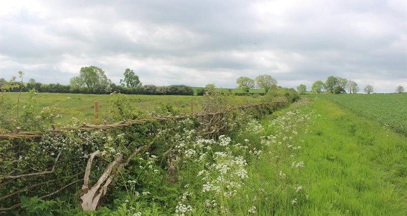
This is important for environmental land management schemes where permanent boundaries and land covers (categories of land shown on RPA mapping) are important to ensure that applications are made on the right basis.
With CS (Countryside Stewardship) and the SFI (Sustainable Farming Incentive), there is now a requirement that the mapping is correct before applying for one of these schemes. Fields are linked to a farmer’s profile and they need to be correct when it comes to registered permanent boundaries and land covers.
In the past, a farmer could tell the RPA about mapping changes at the same time as applying for schemes on such land. Now, mapping changes need to be sorted out before applying.
You can watch our NFU online webinar on the changing landscape of SFI and how accurate mapping is key to a successful application for more information.
Checking your RPA mapping
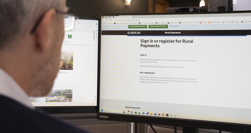
You can see your maps of all the land parcels registered to your holding using the RPA’s Rural Payments service.
To access this, you need to sign into the Rural Payments online service (PIN and password). After successfully logging in, move from the ‘Your businesses and messages’ overview screen and select ‘View business’ on the business linked to the parcels you want to look at. Then, from the ‘Business overview’ screen, select ‘Land’ then ‘View land’.
You should check:
- all your land parcels are shown as linked to your SBI
- the permanent boundaries are shown correctly
- the land covers are shown correctly (this is important when entering schemes such as SFI), and
- that land has not been linked to your SBI by mistake.
Changing from RLE1 forms to rural land changes
For many years, the way that farmers updated their mapping was via a RLE1 (Rural Land and Entitlements) form.
The process has largely remained unchanged, with a paper (or latterly an emailed ‘eRLE1’) form being submitted to the RPA along with sketch maps to request updates to maps, which would then be processed by the RPA and the farmer would be notified of the changes.
While this process was well-known, it needed to be improved as technological enhancements have been developed and a drive to help with service provided.
New rural land changes approach
Launched in January 2024 and communicated to RPA users in the same month, this new digital service which you can use to notify the RPA of mapping changes aimed to replace the eRLE1 form.
A paper version of the RLE1 form is still available for those that need or wish to use it.
In mid-July 2024, the RPA removed the ability to submit an emailed eRLE1 form; the only options available now are the new rural land changes online approach or a posted paper version of the RLE1 form.
The key change behind the scenes has been a streamlining of the handling of the mapping change requests that, with an RLE1 form, meant it needed to be handled a number of times before getting to the team that would look and make the requested changes.
Moving to the new platform that underpins the rural land changes should reduce the length of time it takes the RPA to action submissions from farmers, as the request gets to those that need to work on them quicker.
This is important given both CS and SFI schemes require mapping to be correct before a farmer can complete an application.
The NFU has worked with the RPA to ensure there is a service level indicated for mapping changes to farmers.
This has been set at 28 days when demand is high, but we may not see spikes in demand going forward as we move to monthly start date scheme agreements such as with SFI.
To help, the new approach does ask you to identify which scheme the change may be associated with; this is to help with managing demand and collecting data.
Using the rural land changes option
You can access the rural land changes option via the RPA’s Rural Payments online service, and your login (PIN and password). After successfully logging in, move from the ‘Your businesses and messages’ overview screen and select ‘View business’ on the business linked to the parcels you want to make any changes to.
In the business overview screen, you select ‘Land’ and choose ‘Request Rural Land Changes’. The process can be used for the following actions.
- Register up to 10 new land parcels at a time. Use Magic Maps to get field numbers. You will need to upload annotated maps to support this request.
- Merge up to 5 land parcels at a time (refers to online mapping to select the adjacent parcels).
- Split a land parcel into one or more new land parcels.
- Change single or multiple land covers in a single land parcel; up to 20 parcels for each request can be carried out for a single land cover change in a parcel.
- Make all other land changes (not covered above). This option can include:
- Permanent changes to a land parcel, including changing the size and shape due to a permanent boundary change (not a merger or a split).
- Add or remove a permanent non-agricultural area or feature.
- Link a registered land parcel to another SBI at the same time as it is linked to a farmer’s SBI.
- Merge more than five parcels together.
- Add hedgerows where required.
In addition to the ‘request rural land changes’ functionality, there is another Rural Payment online service option to transfer or remove land.
This is accessed within the business overview; select ‘land’, then select ‘transfer land’.
Where there is a transfer of land to another business or removal from a farm business (now post-BPS this is open all year around), there is a further form that is needed if the land is linked to a holding type shown as tenant or the farmer owns less than 100% of the land parcel and you want to use the online (non RLE1 approach). This can be found at: GOV.UK | Change land tenure form.
You can also update land use via the land use table (that was previously used for BPS) to help with the completion of schemes such as SFI.
Supporting information – You will need to upload annotated supporting maps for all parcels that are included within each submission. On the maps, you need to tell the RPA the type of land change you are requesting and give the RPA all the information needed to be able to check and complete the request.
Additionally, the new functionality can help you view a history of mapping change requests made using the online service for the last 5 years. It will show the ‘effective date of change’ or the ‘date of registration’ that you requested.
If the RPA updates your land parcels, you will receive notifications in the ‘Messages’ tab in the Rural Payments service. You need to check your land maps online to see the changes. The RPA will tell you in writing whether your change has been made or explain why it cannot be made.
More information on the new mapping approach
- Guidance for the new online service and link to the RLE1 form: GOV.UK | Make changes to your rural land maps online or get an RLE1 form.
- Guidance on updating digital maps: GOV.UK | Digital maps in the Rural Payments service: check and change mapping updates.
- Videos are available on YouTube to help understand the new approach: YouTube.com | Rural land change requests.
Additional online mapping functionality
For completeness, you can also use the Rural Payments service in respect of the following land actions.
- Transfer land to another business or remove it from a farm business (now post BPS this is open all year around). There is a further form that is needed if the land is linked to a holding type shown as tenant or the farmer owns less than 100% of the land parcel.
- Update land use (may be needed for an SFI application).
If you are unable to use the Rural Payments service, then it is still possible to use the paper version of the rural land and entitlements (RLE1) form. Find out how to complete a RLE1 form.
Add land functionality
In mid-July 2024, the RPA issued updated information on this service to let the RPA know about existing land parcels or new parcels that you have responsibility for as part of your business and that should be added to your mapping profile on the RPA’s Rural Payments online service.
For example:
- at the end of a tenancy agreement when you regain responsibility for land parcels
- if the land parcel has delinked in the Rural Payments service, and/or
- if the parcel was historically part of a Defra scheme.
It is important that the fields are already registered with the RPA to allow this change to be made. More information can be found on the RPA’s website.
Early reports from the RPA suggest most users are finding the new online approach very useful and changes are being turned around quicker.
Outstanding RPA errors
The NFU is aware that some farmers still face challenges ‘in getting their maps correct or back to what was correct’. The NFU continues to work with the RPA as it develops its mapping process and schemes to ensure members’ concerns are considered.
More information can be found at: GOV.UK | Rural payments: use ‘add land’ service to link registered land to your business.